Garmim next generation of PC charting program?

Sounds simple enough. I also have a 545s with a G2 Vision Card. Where do you get the MapSource disc & how $much$ does it cost?

~ Ken

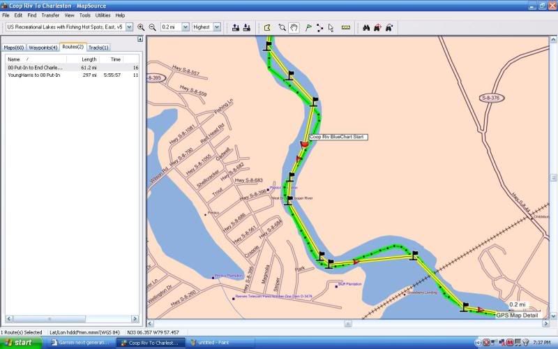
You just have to purchase the BlueChart CD (Not the same as Bluechart G2 Vision data) and depending on where you boat may have to purchase extra unlock codes.

If I remember correctly $150-$200 for the CD with one unlock code. Extra unlock codes are like $100+- each.
 
The Army Corps of Engineers does inland charts... you may want to search on "inland ENC charts" or something like that.


Thanks that is what I thought. I guess you don't have to worry about any inland charts where you cruise. I assume NOAA has you covered. What do you do for facilities info (ie: Marines, Locks, etc) do you have them on your charts or do you add them via a waypoint or something. It nice to be able to see the closest food or marina along the way. You never know when you are going to have to call them via the VHF or Cell phone.
 
Thanx chuck1,

I purchased my 545s @ West Marine last year. I will give them a call to see if they sell the disc. I'm not a techie, so some of the solutions on the previous pages were way over my head. It may be simple for some of these guys, but I just don't understand the lingo. I know what I want to do with what equipment that I have as simple & cost effective as possible.

thanx again ~ Ken
 
Chuck are you saying that if you buy a 535s(which is the model for inland Lakes) it won't have the information you want?
If you already have Mapsource it will work with this unit and you can reinstall any existing routes/waypoints, etc to the new unit. You'll just have to save them to the Device(which in this case is the SD card).
You install a blank SD in the unit it will install a folder on the card. Take the card stick it in your PC and have Mapsource open that card(shows up as a device) and you should be able to save your existing info to the new card.
 
Thanks that is what I thought. I guess you don't have to worry about any inland charts where you cruise. I assume NOAA has you covered. What do you do for facilities info (ie: Marines, Locks, etc) do you have them on your charts or do you add them via a waypoint or something. It nice to be able to see the closest food or marina along the way. You never know when you are going to have to call them via the VHF or Cell phone.

The only inland stuff I've done has been in my 20' jet boat which only drew about 10" of water so I never worried about how shallow things were....

For the 480, it only lives on the coast... I still get the Army Corps of Engineers stuff as they do very recent soundings of all the inlets and you can get that stuff from their website... for example:

http://www.saw.usace.army.mil/nav/OREGON.htm

The charts really need to be backed up with the USACE info before heading out anyway... I just don't leave it all up to the charts and chartplotter...

As far as knowing where to stop, I carry a few guidebooks... I like print things... plus I usually have everything planned out before I head out...

Read my book. ;-)

Good point. I did not know if you had anything like the SC trips I was talking about in your area via locks. I hear you about the planning I like to use one program to store it all, plus have the printed backups.

I'm still waiting on your book. Must have gotten lost in the mail(Grin)
 
Chuck are you saying that if you buy a 535s(which is the model for inland Lakes) it won't have the information you want?
If you already have Mapsource it will work with this unit and you can reinstall any existing routes/waypoints, etc to the new unit. You'll just have to save them to the Device(which in this case is the SD card).
You install a blank SD in the unit it will install a folder on the card. Take the card stick it in your PC and have Mapsource open that card(shows up as a device) and you should be able to save your existing info to the new card.

That is correct. You can tranfer the waypoints, tracks, routes etc between the PC and GPS. The problem comes in when you want to use the charts on both. There is noway to use the preprogramed card charts on the pc and you can't purchase the same charts on CD even if you wanted to.
 
That is correct. You can tranfer the waypoints, tracks, routes etc between the PC and GPS. The problem comes in when you want to use the charts on both. There is noway to use the preprogramed card charts on the pc and you can't purchase the same charts on CD even if you wanted to.

Do you mean to install the G2 Vision card in the PC to see all that Detail on your PC, plan, then Save that to a new SD card to transfer to the Unit?
 
Do you mean to install the G2 Vision card in the PC to see all that Detail on your PC, plan, then Save that to a new SD card to transfer to the Unit?

Bingo:thumbsup: You can't use the chart data on the PC.
 
Bingo:thumbsup: You can't use the chart data on the PC.

Do you need all of that though? If you're just using the software to plot routes and waypoints, then save them to the GPS, Plug in the G2 Vision card and it should all overlay. What are you looking to do/see?
 
Do you need all of that though? If you're just using the software to plot routes and waypoints, then save them to the GPS, Plug in the G2 Vision card and it should all overlay. What are you looking to do/see?

If you don't have any charts how are you going to plot it on the PC. Here is screen shoots of Mapsource The same route & tracks shown with different charts.

MSBlueChartV95.jpg

Bluechart V9.5
Notice how the water ends???


MSBluechartV95Tides.jpg

Bluechart V9.5 Tides & Serives. If this was in an area it would show marina. You can see one Tide station. If you click on it in the program it will give you the tide info. If there was a marina when you click on it you would see the marina info, etc.

MSCityNavNorthAmerica2008.jpg

City Nav North America.
Good for driving, but also you can see the rest/bar POI. If you click on it you have the info for it.


MSUSInlandLakes2008.jpg

US Inland Lakes 2008
Notice the Day Marker. And yes there is water.


MSUSRecLakeswithFishing.jpg

US Rec Lakes with Fishing hot spots. None show in this area, but in other areas will give alot of details like depths, markers, etc.


So, yes you do need the charts to be able to plan routes.

Hope this helps.

Just to make myself clear, When I have a route/trip planned out. I can tranfers all the charts,routes,waypoints, etc to the garmin GPS.
 
Last edited:
Ok Chuck, nice screen shots and point well-made, but what IS UP with that course?!

It appears that in order to follow what you plotted, you'd have to keep the trailer attached to the boat - you know, so you can drive over that landmass more easily...

:grin:

Just to re-iterate what we've all agreed upon:

The problem isn't that there aren't alternatives to buying Garmin map data or other ways to use a PC to plot and transfer to the unit. The issue is that in order to use Garmin's excellent products on a PC and plotter, we have to purchase the maps TWICE. That's not the way it used to be, and it's not the way it SHOULD be now.
 
I get what you're saying Chuck. My Mapsource product (I gave away with the last boat....damn it) was US Waterways and lights, so I had that detail. I can't buy that version any longer.
 
Ok Chuck, nice screen shots and point well-made, but what IS UP with that course?!

It appears that in order to follow what you plotted, you'd have to keep the trailer attached to the boat - you know, so you can drive over that landmass more easily...

:grin:

Just to re-iterate what we've all agreed upon:

The problem isn't that there aren't alternatives to buying Garmin map data or other ways to use a PC to plot and transfer to the unit. The issue is that in order to use Garmin's excellent products on a PC and plotter, we have to purchase the maps TWICE. That's not the way it used to be, and it's not the way it SHOULD be now.

Want can I say some times I like to take short cuts when laying out the route, at the track stayed in the water(Grin) Seriously not sure if you run many rivers, but they are always changing so I just try to give myself a good overview of the route and then read the river as I'm going.

Yep that about sums it up. Even if you want to purchase a second set of maps/charts for the PC you can't purchase the sames ones that you use on the GPS.
 
Side note: Not sure if you noticed but the screen shoots are all at the same spot. Interesting to see the differences in the charts for the same spot. Some show land and some show water.
 
I couldn't resist. Gary can't have ALL the fun! :lol:

I DO run a lot of rivers, and that's another reason I like MapSource - for its features of managing previous tracks. I like to compare runs I've made to the data. I can use the tracks to compare changes over time, close calls, most efficient routes etc.
 
I also use the MapSource program. I really, really like the track managment features.
I use it to periodically download all my tracks, and keep only the ones I really want to preserve on the GPS. It is also far more convienient to relabel and change icons on waypoints using the PC.

(I maintain locations of all local bouys and daysticks on the GPS as waypoints. This is important when coming home at night.)

It is surprising that the water maps can't be used on a PC. It is *not* that way for the road maps. I am allowed two (I think -> I use two) installs to a PC for my US and Europe road maps. That is nice to have. I have had phone calls from the Admiral looking for directions while I am at home on my PC. Kinda like her own personal OnStar.

- - - -

On a related but off topic note. . prompted by this thread, I looked up the latest mapupdate for my Road GPS. It now seems like Garmin has switched from a $80 annual DVD update to a $120 lifetime download update plan (4x per year) ($150 for US and Europe).

Upon Emailing Garmin, they told me that these updates can also be used to update the PC versions of the maps. (like their DVD's, you can only use the update on one GPS unit)
 
Update: Well we must not be the only ones complaining about the problem. Talked with Garmin Tech Support about it. Yes they know they have a big problem. The tech I was talking with said they have had a bunch a calls about it. At this time there is no fix. Yes you can buy maps that don't work with the new units and use them on the PC. He hopes they are working on a new program or a way to use the maps from the new unit, but at this time nobody know (IF or WHEN) it will happen???
 
What the hell is a "daystick"?


Oops. . missed that.

It is a Nav hazard that consists of a tall piece of sappling with a triangle or square on it. They use them to guide you into marinas, being placed in pairs every 100 feet or so.

Of course. . you can't see them at night -> which is why I consider them hazards. By mid season, they basically transform into sharp pointed sticks that jut out about 12" off the water.

But at least they are better than the unlit "no wake" bouys that are occassionally placed in the ICW. . . . .
 

Forum statistics

Threads
113,172
Messages
1,427,834
Members
61,084
Latest member
AntonioJamm
Back
Top