- Feb 5, 2009
- 827
- Boat Info
- 560DB
2 x Raymarine e125's
Walker Bay Generations 360 Centre Console w. Yahama 60HP
2 Seadoos
- Engines
- CAT 3406e (C15's) @ 800HP
I’ve had a couple of PMs requesting some additional photos of Georgian Bay and surrounding parts, here is: “My Summer Vacation” by JJ V. :grin:
We typically do a number of smaller trips during the boating season and take a larger 2 week trip sometime in August. More often than not, this involves a trip to the North Channel and this year was no exception.
WARNING – there are a lot of pics here – which is bad if you’re on limited bandwidth – but perhaps good if you’re suffering the winter blues... :smt100 Also, no CSR hard drives were damaged in the making of this post – all the pics are on Photobucket....
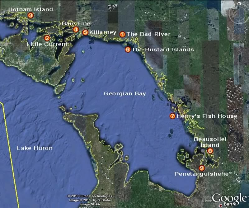
Here’s a route map of our trip with the points we hit.
Our agenda was not as ambitious as last year (which took us across the top of Lake Huron and knocking on the door of Superior), but nonetheless, we covered decent ground though a period when most days which were under "Strong Wind Warnings" from the Canadian Coast Guard.
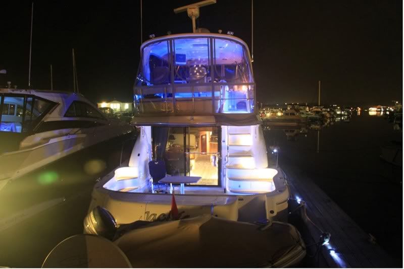
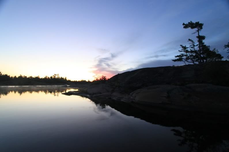
Here’s a quick shot of JJV on the calm evening prior to our departure. I’m not sure why this is, but it seems that everytime we mount one of these expeditions up the Bay, the evening before is always calm and then the following day things start to blow up!
The objective for day one would be to get to The Bad River, which was an area I had not visited before (now after being there – I’m not sure why I didn’t hit this spot before now). The day started out fine and we planned out route for the outside. As progressed, the winds started to pick up and the fog set in, so three of four boats decided to tuck into a more sheltered route about half way up Georgian Bay as the skies turned grey and the wind and waves picked up.
Unfortunately, one of the three dinged a prop (well more than a ding really...) and got escorted into the Town of Britt where he be hauled up on blocks for the week and a half it would take to complete repairs. So now with two vessels left in Britt (damaged boat plus one for moral support), I continued on to the Bad River. Unfortunately Britt doesn’t really have the facilities to support a 560DB.
So only one day into a two week trip, we’ve already scattered the fleet... D’Oh! :smt021 Also, the winds were whipping up pretty good by this point but most of the trip was pretty sheltered. It was a beautiful clear day, but the clouds were starting to build up into the thunderstorms that would come later.
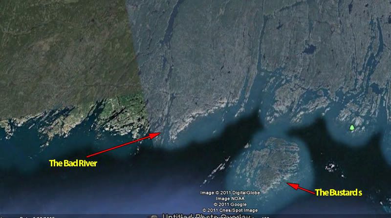
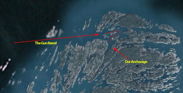
The Bad River area is near the Bustard Islands in the North East corner of Georgian Bay. Here’s an area map.
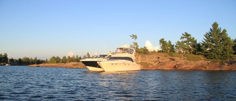
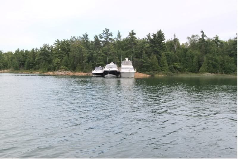
So with Day one complete, covering just over 100 miles, we finally made it to our destination and rafted up.
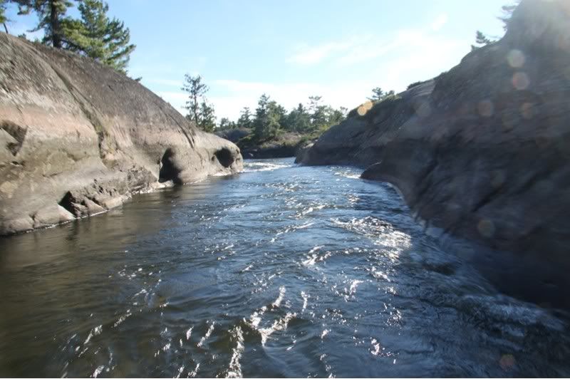
The Bad River looked to hold a lot of promise for exploring in the dingy. It is also pretty typical of the rugged beauty in this area, and offer decent shelter to pretty much all winds except for those coming directly out of the south (which as it turned out would pretty much be the wind – with small craft wind warnings in effect – for the next three days).
The Bad River is also a little tricky to figure out when entering for the first time. A mistake would be costly, given all the granite lurking just below the water waiting to take yet another victim. Here’s a map of the approach:
Obviously, if you’re planning to do any expeditions in this area, full paper charts are a necessity. Even then, I found the approach a little confusing and extra caution is recommended. The line marking the approaches, seems to take you into what appears to be the more open side of green marker. That line though, is only showing the angle of approach and you clearly keep the green marker to port (which will appear to be a pretty obvious tip to all who haven’t made this specific approach before). If you’re in the channel though, there’s lots of water taking you all the way into the anchorage area.
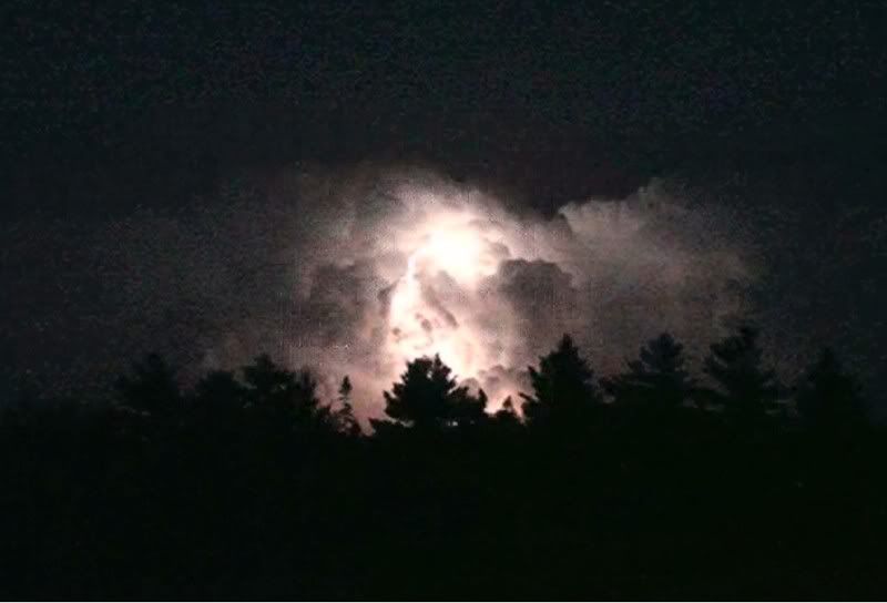
Up in our neck of the woods, pretty much any summer day brings with it, the potential for an evening thunderstorm and day would be no different. As the afternoon progressed, there appeared the typical build up of thunder clouds reaching for the sky:
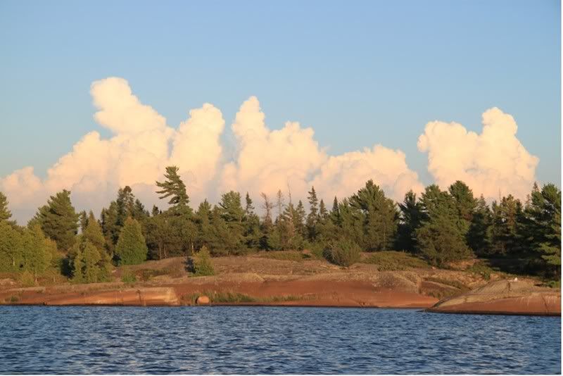
And continued to build as the evening set in.
And sure enough, later that night we enjoyed a pretty spectacular show of light off to the southeast of our anchorage. These photos don't do justice to the majesty of the storm:
The following morning, much to my surprise, boater that stayed in Britt to provide moral support, set out in some pretty strong winds to catch up with the remnants of the fleet. After he got into the anchorage and rafted off, I went out to the mouth of our sanctuary to check out the open waters. Here's the sea conditions that the he plowed through to catch up. Photos never do justice to the conditions. These would have been 8 to 10 foot short chop seas - very uncomfortable!
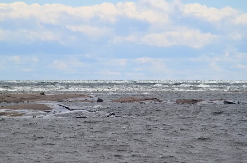
Interesting weather can make for interesting photos though, featuring the rugged beauty of this area.
The vantage point here is looking due south. So the winds were coming at us from pretty much the only angle that our anchorage did not provide shelter from...
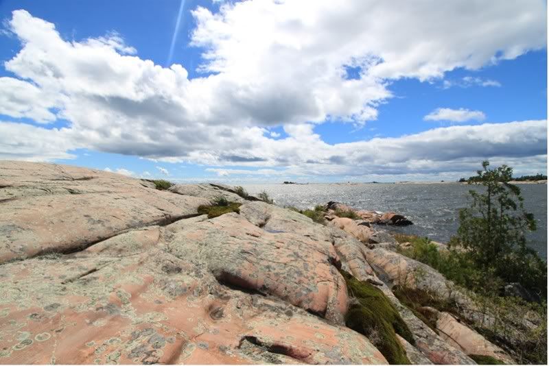
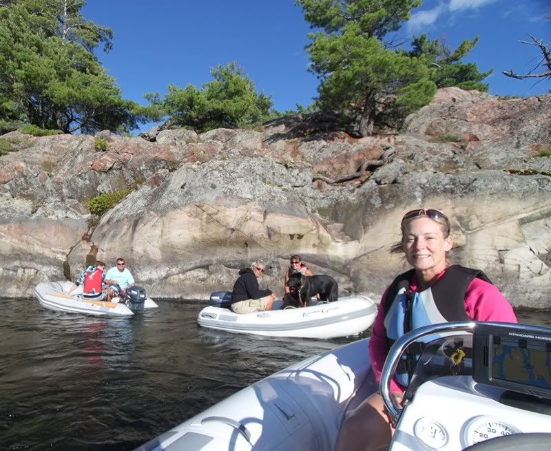
In any event, we ended up deciding to hang tight for three days, which provided tons of time to explore the area in our dingys (and maybe a little poker...) :thumbsup: As I highlighted in the map above, this area is ‘dingy heaven’. It is the western tributary of the French River delta, which brought the Voyagers in the 1700’s looking for opportunities for trade and to find the western passage to the orient. There are a number of little tributaries and water falls to explore. Just spectacular!
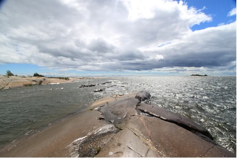
Here we are on one of our standard evening cruises.
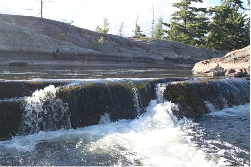
Here’s one of the many little waterfalls carved out of the rock in is area
And one of the many chutes carved out of the rock from the run off of retreating glaciers eons ago...
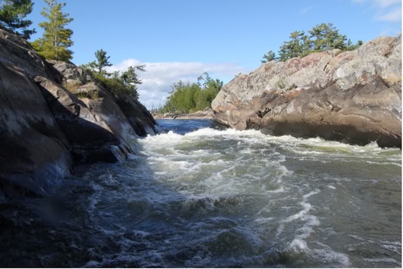
It’s a lot of fun to push the dingy into the current and get pushed around. Really gives you a sense of the power of moving water....
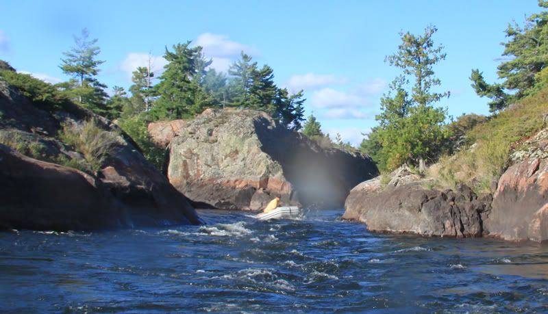
Another little waterfall encountered on our expedition:
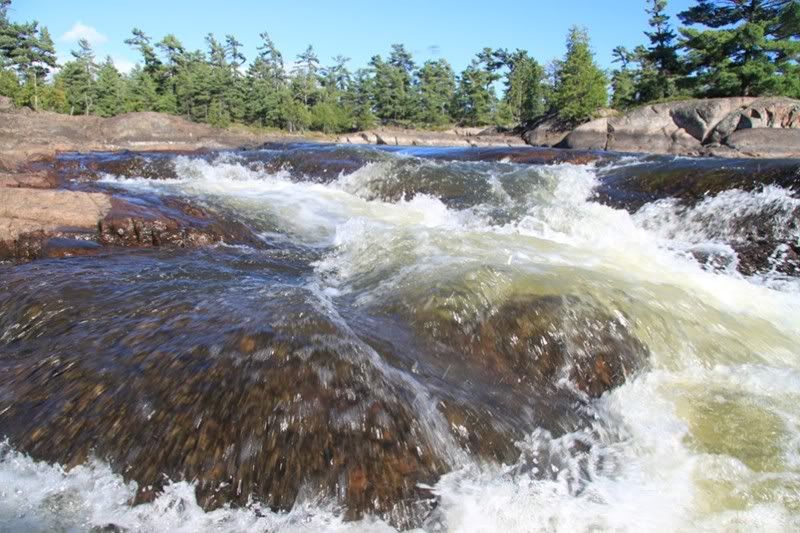
And another chute.
After running up and down, we figured that this chute, while only about 10 feet across, was also 6 feet or so deep the whole way down...perfect for running on plane (with one dingy posted at the bottom to make sure no one was coming up). Makes you feel like 007 on a run through Venice. J
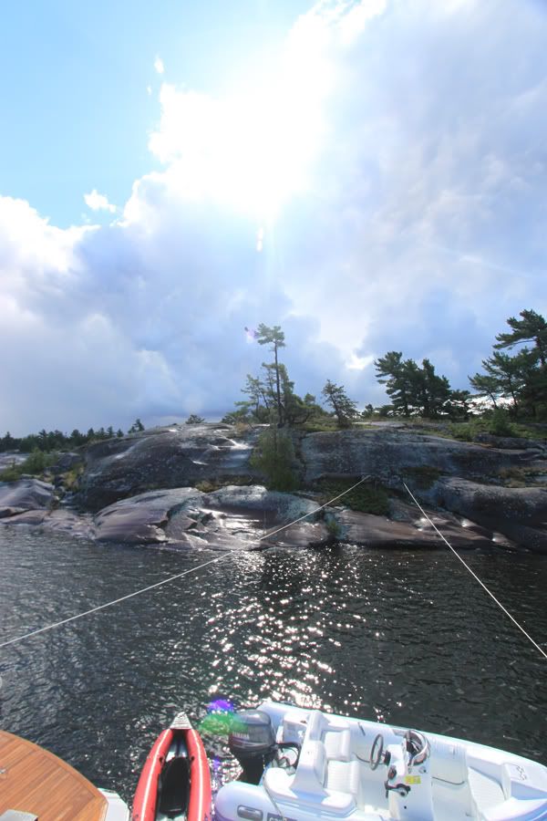
Up in this neck of the woods, there are more than a few ways that boaters set-up for the night, including this Viking who decided to anchor tied directly to the rocks:
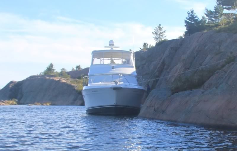
I think I'd be a little more than uncomfortable doing this though, as I'd be concened about the winds changing and grinding my fiberglass against the granite. Guess who would win in that case...
FInally, on the third morning the winds subsided:
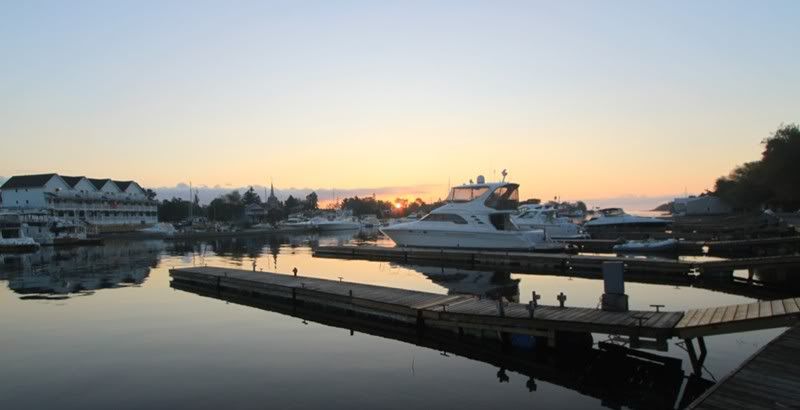
It was in fact, a spectacular sunrise:
This was great to see as we were all pretty determined to be heading on that morning anyway. Much better that we'd be seeing smooth seas than having to endure the tempest of the preceding couple of days.
Next stop was Little Current for powering up and provisioning. Here's the three amigos in Little Current at sunset:
After a night in Little Current, we were heading west for an anchorage at a little spot a fellow boater had recommended. After clearing the markers, we hopped up on plane and after about a minute, I felt a thump and the boat started to shudder. First thought was that I must have hit something – but I was in 120 feet of water! Came off plane and checked around. Then after a couple of tests, determined that it was fine to limp back to port to figure out what needed to be done.
One interesting discovery in the process. With the hydraulic swim platform full dropped, you can lie on the platform and look at the props. That could be helpful in certain circumstances!
What I found was a dark blue (i.e., exactly the colour of water), poly tarp wrapped around the port prop and shaft. I was actually happy to see this, given the alternative was damaged running gear. I dove in any started cutting away, however wasn’t making enough progress given the amount of tarp that was down there. I decided to give up and go into town to find a diver, who showed up the next morning help me out. He must have been underneath for a sustained 20 minutes hacking away, before clearing the prop and shaft. Here’s a couple of shots of what was cut away.
After clearing the canvas entanglement, we headed on to Oak Point (Hotham Island).
This spot, just north of the Benjamins, came highly recommended by a knowledgeable boater at our marina, however I found it to be kind of boring. There are many more interesting spots and I’m not sure I’d head back there again.
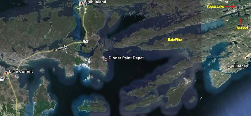
After Hotham, we were of to Baie Fine. Baie Fine is a spectacular visit, very much like a land locked fiord cut out of the white quartz La Cloche mountains. Definitely worth the visit if you’re in the area.
Here’s a map of Baie Fine.
There are a couple of tight spots going in, so consult your charts. It is about 10 miles from the start of the Baie (the old Okachobee Lodge) to the bottom and the Pool. Here’s a shot of our anchorage down in the bottom of the Baie...
Just outside the Evinrude family cottage...
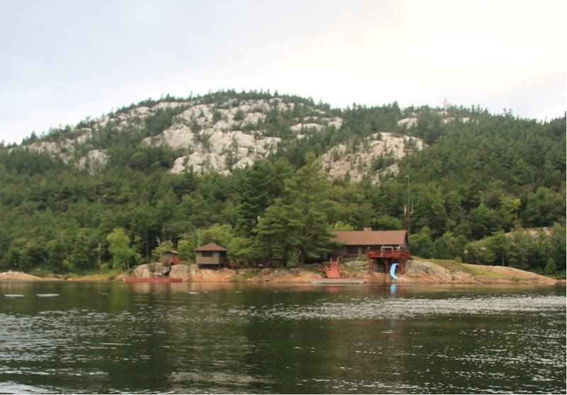
...and just outside “the Pool”. The Pool is generally regarded as a great anchorage and is very well sheltered. For the past few years though, I have found it to be very weedy and have avoided it. I’m not a big fan of constantly clearing the generator, even for the limited time that we run it to recharge the batteries.
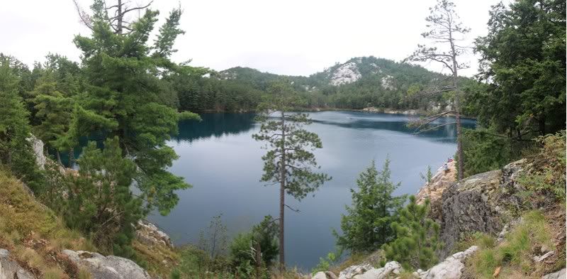
When you’re down in this area, you’re actually on the fringes of Killarney Provincial Park, which provides excellent hiking opportunities. One that you have to take, it the short (but steep) hike up to Topaz Lake, which is a little jewel of crystal clear water:
If you’re up for a longer hike, you can also take the route back to Artist Lake
...and beyond to O.S.A. Lake.
These Lakes are so named to recognize the contribution of certain members of the Group of Seven to the original formation of Park. Paintings by the Group of Seven are pure Canadiana and an important part of our cultural heritage (Google if you’re interested). Member AY Jackson was instrumental to the original designation of these areas as parklands thus protecting from the significant logging in the area (not that there was anything wrong with logging...just that these lake should be protected). O.S.A. is the Ontario Society of Artists.
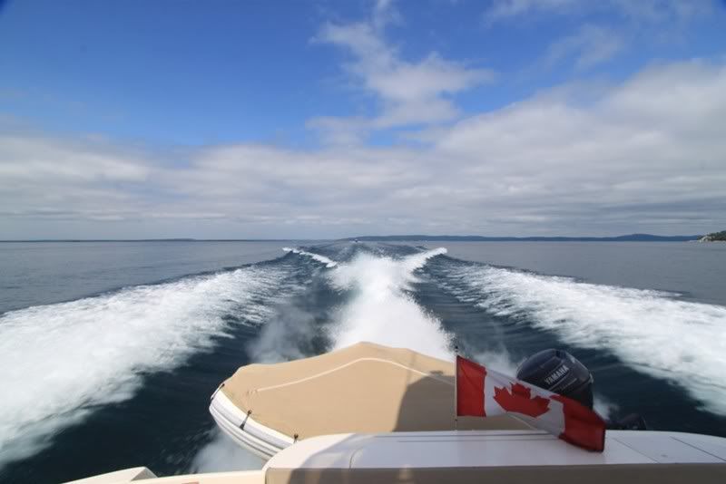
Leaving Baie Fine, we headed off for the Town of Killarney, providing the opportunity for a couple of gratuitous wake shots J....
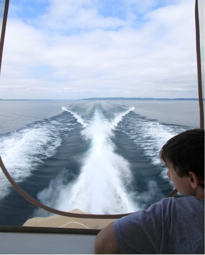
That one became the cover for our marina’s winter newsletter magazine...
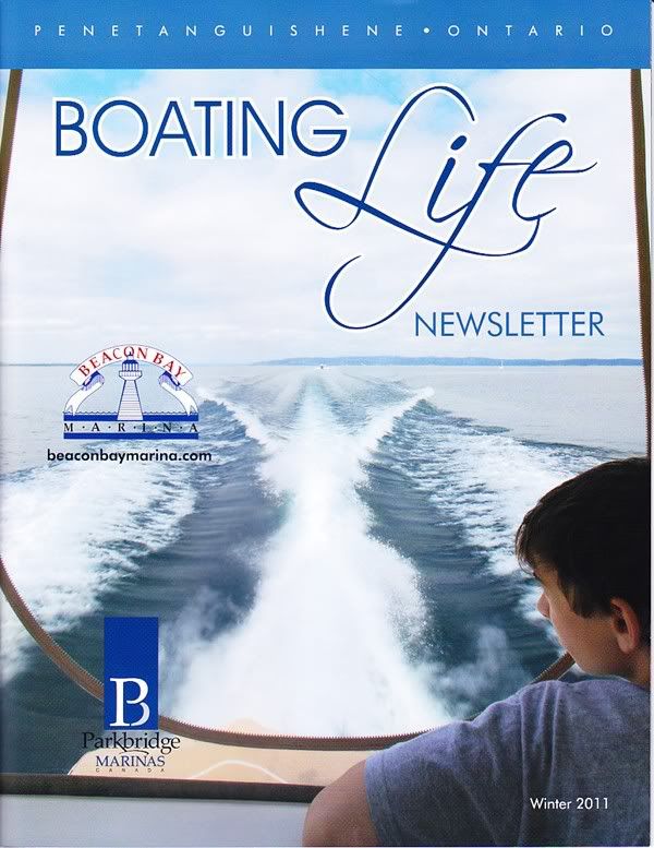
I love gratuitous wake shots...sorry... :grin:
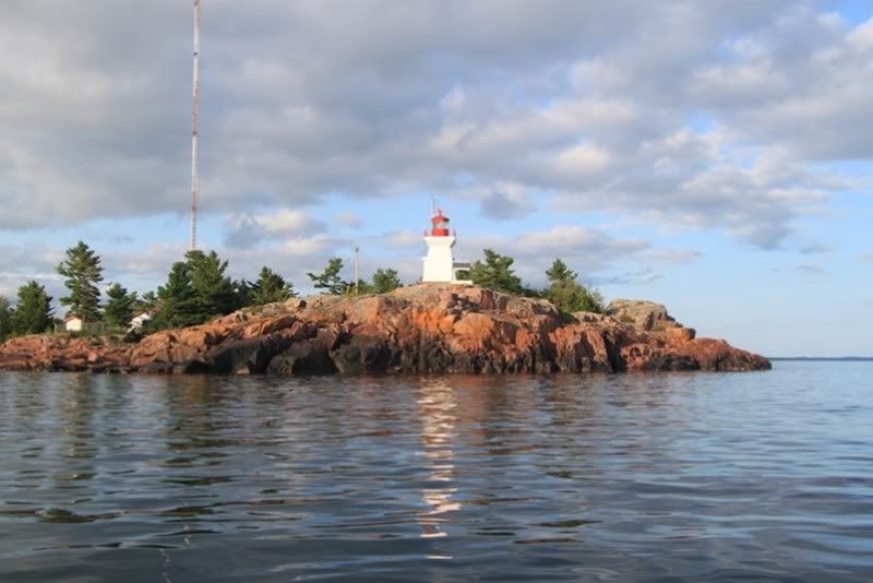
Here’s an evening shot of the Killarney lighthouse...
...and sunrise over the town of Killarney and the Sportsman’s Inn.
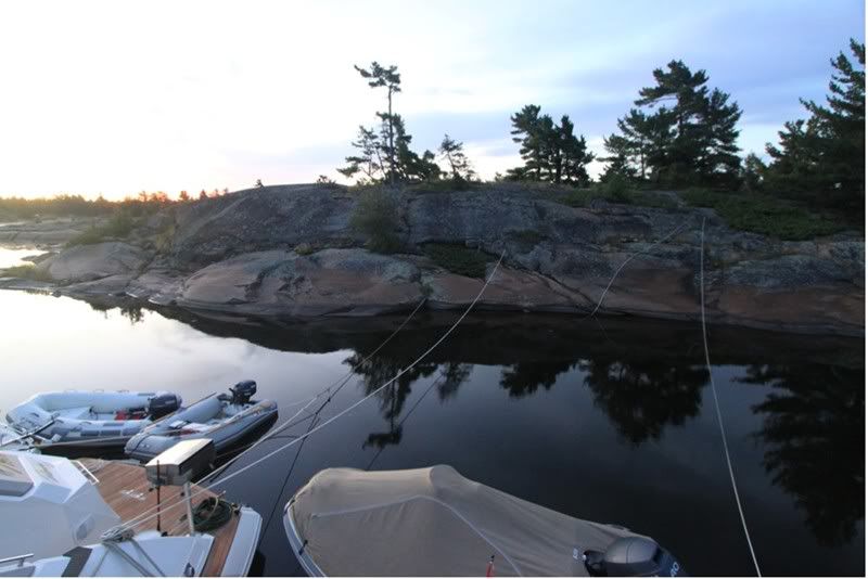
All the while we’ve been on our trip, we’ve been getting regular updates on the repairs happening to the boat of our friend left behind in Britt (Byng Inlet). As it looked as though things would be coordinated for our return visit, we decided to head to the Bustards for the night, and then pick up our friend in Byng on the following day (no man gets left behind)
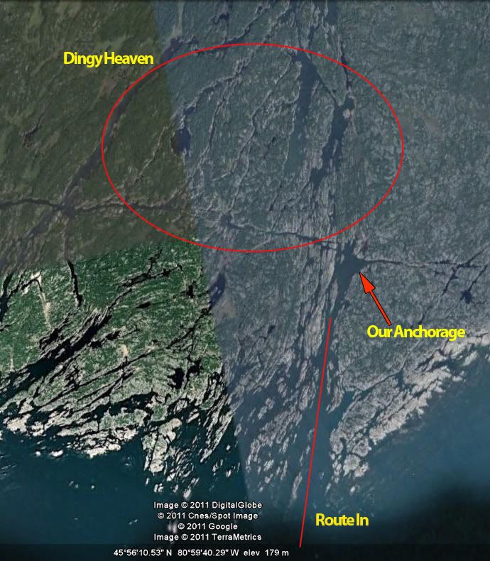
For those interested, here’s a map the Bustard Islands showing the route in.
It’s a great little, well protected anchorage. Again...consult your charts.
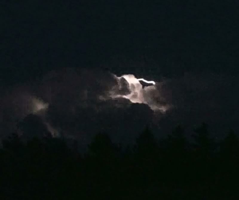
The next day, after picking up our buddy in Byng we headed to Henry's for the night. Here's a shot of the moonrise over Henry's:
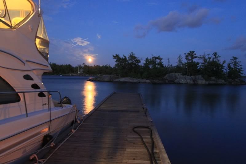
Or as some of you may know it...January in the 2010 CSR Calendar.
Good times...
Paul
We typically do a number of smaller trips during the boating season and take a larger 2 week trip sometime in August. More often than not, this involves a trip to the North Channel and this year was no exception.
WARNING – there are a lot of pics here – which is bad if you’re on limited bandwidth – but perhaps good if you’re suffering the winter blues... :smt100 Also, no CSR hard drives were damaged in the making of this post – all the pics are on Photobucket....
Here’s a route map of our trip with the points we hit.
Our agenda was not as ambitious as last year (which took us across the top of Lake Huron and knocking on the door of Superior), but nonetheless, we covered decent ground though a period when most days which were under "Strong Wind Warnings" from the Canadian Coast Guard.
Here’s a quick shot of JJV on the calm evening prior to our departure. I’m not sure why this is, but it seems that everytime we mount one of these expeditions up the Bay, the evening before is always calm and then the following day things start to blow up!
The objective for day one would be to get to The Bad River, which was an area I had not visited before (now after being there – I’m not sure why I didn’t hit this spot before now). The day started out fine and we planned out route for the outside. As progressed, the winds started to pick up and the fog set in, so three of four boats decided to tuck into a more sheltered route about half way up Georgian Bay as the skies turned grey and the wind and waves picked up.
Unfortunately, one of the three dinged a prop (well more than a ding really...) and got escorted into the Town of Britt where he be hauled up on blocks for the week and a half it would take to complete repairs. So now with two vessels left in Britt (damaged boat plus one for moral support), I continued on to the Bad River. Unfortunately Britt doesn’t really have the facilities to support a 560DB.
So only one day into a two week trip, we’ve already scattered the fleet... D’Oh! :smt021 Also, the winds were whipping up pretty good by this point but most of the trip was pretty sheltered. It was a beautiful clear day, but the clouds were starting to build up into the thunderstorms that would come later.
The Bad River area is near the Bustard Islands in the North East corner of Georgian Bay. Here’s an area map.
So with Day one complete, covering just over 100 miles, we finally made it to our destination and rafted up.
The Bad River looked to hold a lot of promise for exploring in the dingy. It is also pretty typical of the rugged beauty in this area, and offer decent shelter to pretty much all winds except for those coming directly out of the south (which as it turned out would pretty much be the wind – with small craft wind warnings in effect – for the next three days).
The Bad River is also a little tricky to figure out when entering for the first time. A mistake would be costly, given all the granite lurking just below the water waiting to take yet another victim. Here’s a map of the approach:
Obviously, if you’re planning to do any expeditions in this area, full paper charts are a necessity. Even then, I found the approach a little confusing and extra caution is recommended. The line marking the approaches, seems to take you into what appears to be the more open side of green marker. That line though, is only showing the angle of approach and you clearly keep the green marker to port (which will appear to be a pretty obvious tip to all who haven’t made this specific approach before). If you’re in the channel though, there’s lots of water taking you all the way into the anchorage area.
Up in our neck of the woods, pretty much any summer day brings with it, the potential for an evening thunderstorm and day would be no different. As the afternoon progressed, there appeared the typical build up of thunder clouds reaching for the sky:
And continued to build as the evening set in.
And sure enough, later that night we enjoyed a pretty spectacular show of light off to the southeast of our anchorage. These photos don't do justice to the majesty of the storm:
The following morning, much to my surprise, boater that stayed in Britt to provide moral support, set out in some pretty strong winds to catch up with the remnants of the fleet. After he got into the anchorage and rafted off, I went out to the mouth of our sanctuary to check out the open waters. Here's the sea conditions that the he plowed through to catch up. Photos never do justice to the conditions. These would have been 8 to 10 foot short chop seas - very uncomfortable!
Interesting weather can make for interesting photos though, featuring the rugged beauty of this area.
The vantage point here is looking due south. So the winds were coming at us from pretty much the only angle that our anchorage did not provide shelter from...
In any event, we ended up deciding to hang tight for three days, which provided tons of time to explore the area in our dingys (and maybe a little poker...) :thumbsup: As I highlighted in the map above, this area is ‘dingy heaven’. It is the western tributary of the French River delta, which brought the Voyagers in the 1700’s looking for opportunities for trade and to find the western passage to the orient. There are a number of little tributaries and water falls to explore. Just spectacular!
Here we are on one of our standard evening cruises.
Here’s one of the many little waterfalls carved out of the rock in is area
And one of the many chutes carved out of the rock from the run off of retreating glaciers eons ago...
It’s a lot of fun to push the dingy into the current and get pushed around. Really gives you a sense of the power of moving water....
Another little waterfall encountered on our expedition:
And another chute.
After running up and down, we figured that this chute, while only about 10 feet across, was also 6 feet or so deep the whole way down...perfect for running on plane (with one dingy posted at the bottom to make sure no one was coming up). Makes you feel like 007 on a run through Venice. J
Up in this neck of the woods, there are more than a few ways that boaters set-up for the night, including this Viking who decided to anchor tied directly to the rocks:
I think I'd be a little more than uncomfortable doing this though, as I'd be concened about the winds changing and grinding my fiberglass against the granite. Guess who would win in that case...
FInally, on the third morning the winds subsided:
It was in fact, a spectacular sunrise:
This was great to see as we were all pretty determined to be heading on that morning anyway. Much better that we'd be seeing smooth seas than having to endure the tempest of the preceding couple of days.
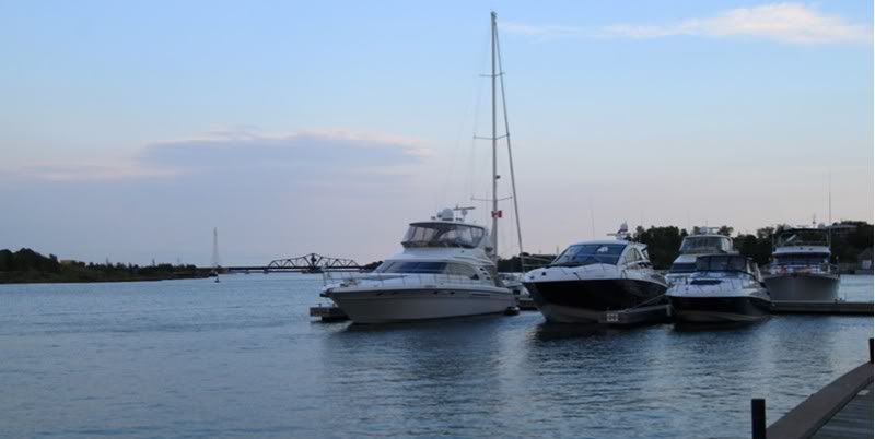
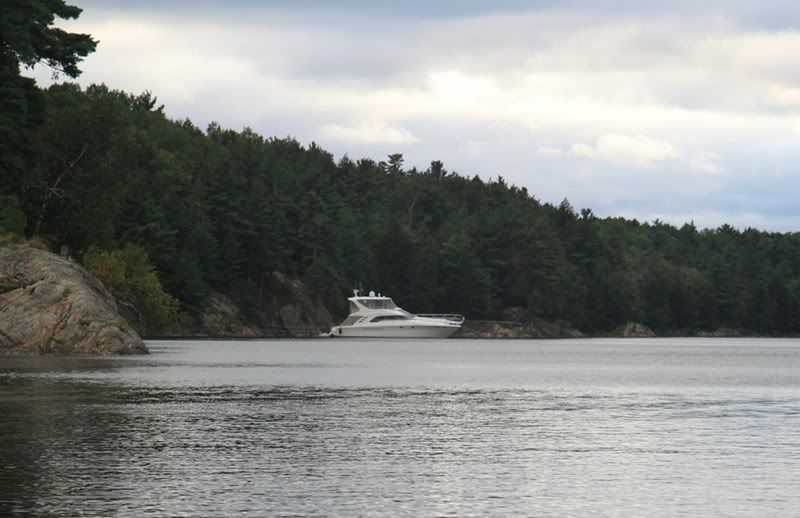
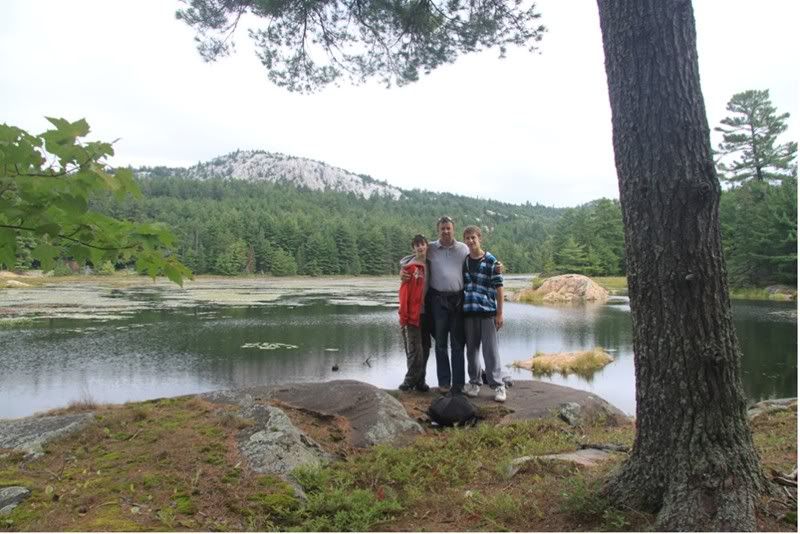
Next stop was Little Current for powering up and provisioning. Here's the three amigos in Little Current at sunset:
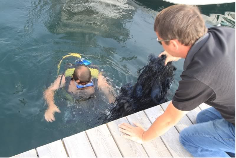
After a night in Little Current, we were heading west for an anchorage at a little spot a fellow boater had recommended. After clearing the markers, we hopped up on plane and after about a minute, I felt a thump and the boat started to shudder. First thought was that I must have hit something – but I was in 120 feet of water! Came off plane and checked around. Then after a couple of tests, determined that it was fine to limp back to port to figure out what needed to be done.
One interesting discovery in the process. With the hydraulic swim platform full dropped, you can lie on the platform and look at the props. That could be helpful in certain circumstances!
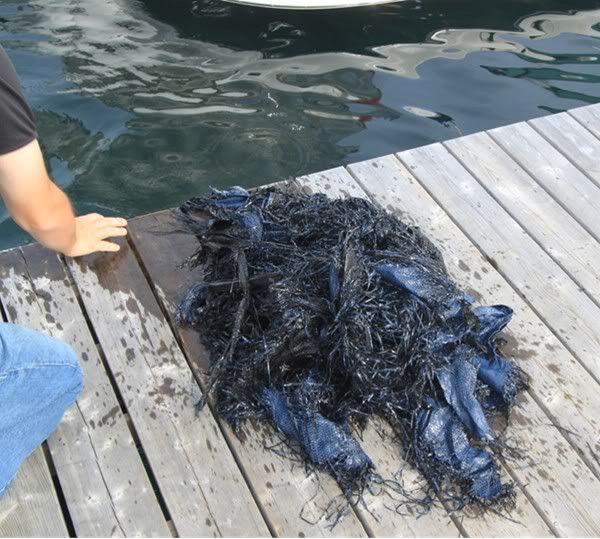
What I found was a dark blue (i.e., exactly the colour of water), poly tarp wrapped around the port prop and shaft. I was actually happy to see this, given the alternative was damaged running gear. I dove in any started cutting away, however wasn’t making enough progress given the amount of tarp that was down there. I decided to give up and go into town to find a diver, who showed up the next morning help me out. He must have been underneath for a sustained 20 minutes hacking away, before clearing the prop and shaft. Here’s a couple of shots of what was cut away.
After clearing the canvas entanglement, we headed on to Oak Point (Hotham Island).
This spot, just north of the Benjamins, came highly recommended by a knowledgeable boater at our marina, however I found it to be kind of boring. There are many more interesting spots and I’m not sure I’d head back there again.
After Hotham, we were of to Baie Fine. Baie Fine is a spectacular visit, very much like a land locked fiord cut out of the white quartz La Cloche mountains. Definitely worth the visit if you’re in the area.
Here’s a map of Baie Fine.
There are a couple of tight spots going in, so consult your charts. It is about 10 miles from the start of the Baie (the old Okachobee Lodge) to the bottom and the Pool. Here’s a shot of our anchorage down in the bottom of the Baie...
Just outside the Evinrude family cottage...
...and just outside “the Pool”. The Pool is generally regarded as a great anchorage and is very well sheltered. For the past few years though, I have found it to be very weedy and have avoided it. I’m not a big fan of constantly clearing the generator, even for the limited time that we run it to recharge the batteries.
When you’re down in this area, you’re actually on the fringes of Killarney Provincial Park, which provides excellent hiking opportunities. One that you have to take, it the short (but steep) hike up to Topaz Lake, which is a little jewel of crystal clear water:
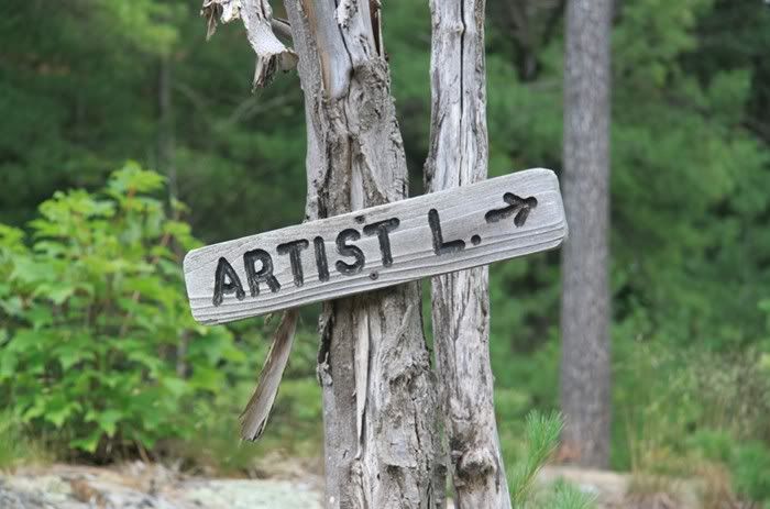
If you’re up for a longer hike, you can also take the route back to Artist Lake
...and beyond to O.S.A. Lake.
These Lakes are so named to recognize the contribution of certain members of the Group of Seven to the original formation of Park. Paintings by the Group of Seven are pure Canadiana and an important part of our cultural heritage (Google if you’re interested). Member AY Jackson was instrumental to the original designation of these areas as parklands thus protecting from the significant logging in the area (not that there was anything wrong with logging...just that these lake should be protected). O.S.A. is the Ontario Society of Artists.
Leaving Baie Fine, we headed off for the Town of Killarney, providing the opportunity for a couple of gratuitous wake shots J....
That one became the cover for our marina’s winter newsletter magazine...
I love gratuitous wake shots...sorry... :grin:
Here’s an evening shot of the Killarney lighthouse...
...and sunrise over the town of Killarney and the Sportsman’s Inn.
All the while we’ve been on our trip, we’ve been getting regular updates on the repairs happening to the boat of our friend left behind in Britt (Byng Inlet). As it looked as though things would be coordinated for our return visit, we decided to head to the Bustards for the night, and then pick up our friend in Byng on the following day (no man gets left behind)
For those interested, here’s a map the Bustard Islands showing the route in.
It’s a great little, well protected anchorage. Again...consult your charts.
The next day, after picking up our buddy in Byng we headed to Henry's for the night. Here's a shot of the moonrise over Henry's:
Or as some of you may know it...January in the 2010 CSR Calendar.
Good times...
Paul
Last edited: