Sea Path 44
New Member
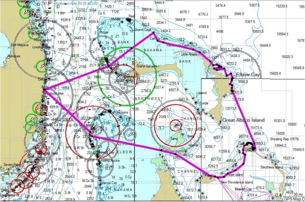
We are planning to cruise the Bahamas during the month of June in our 2006 44 sedan. Course: Ft Lauderdale, West End, Green Turtle Cay, Treasure Cay, Marsh Harbor, Hope Town, Elbow Cay, Little Harbor, Paradise Island, Compass/Staniel Cay, back to Paradise Island, Chub Cay, Bimini, Ft Lauderdale. Using Explorer Charts and using their suggested waypts, though I realize the concept of visual navigating in the Bahamas is best practice. I feel the most challenging run will be through Whale Cay Pass, the run from Little Harbor-Abaco down to Paradise Island, the run from Chub Cay to Bimini. I have time to wait for good weather/sea conditions. Any suggested dos and don'ts while curising such as places to see on the way, areas to cruise slowly, coral heads tough to see as certain areas, better places to buy diesel fuel, etc.