Tropical Storm Ian Prediction as of 0200 EDT.

ttmott

PhD in OCD
GOLD Sponsor
TECHNICAL Contributor
Apr 3, 2012
8,105
Space Coast Florida
Boat Info
2006 52 Sedan Bridge
Engines
Cummins QSM11
085539.png

085539_earliest_reasonable_toa_no_wsp_34.png

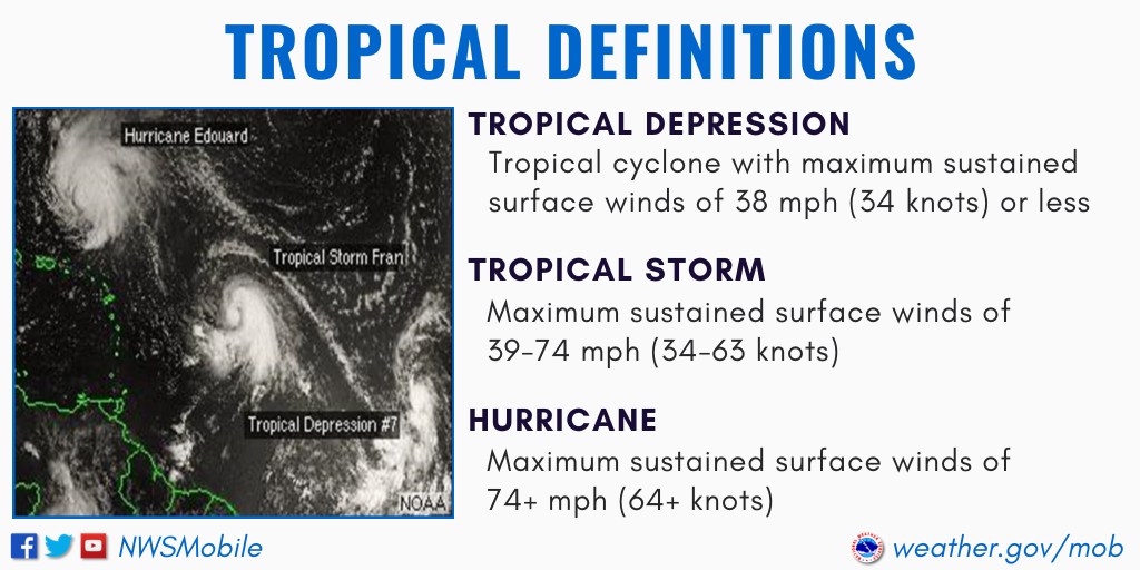
_Basic_Definition.png
Expected to gain in strength -
 
Went through 5 of them during my years in Florida. None were direct hits to my location but each one disrupted life for a week or so following it.
Get ready for a run on French toast ingredients at the grocery stores and make sure you have gas for the generator.
 
been through both the EYE of CAT 4 Charley 2004 and the EYE Cat 2 Irma - 2017 with my 10 Meter spider webbed in the canal behind the house.

I have a good drill down and suffered no significant losses (other than radar arch damage) either time.

PREP PREP PREP !

RWS
 
I like mine a bit better…. I think tomorrow will narrow it down some

54762CBB-5658-4181-89DB-F9B38F529167.png
 
Crown put out an update at midnight last night:

Late Friday Night Update – Tropical Depression #9 Has Strengthened Into Tropical Storm Ian Over The Central Caribbean
Posted on Friday, September 23, 2022 11:56 pm


A late Friday Night update for all of our Crown Weather Plus subscribers on what is now Tropical Storm Ian –

Even though Ian continues to be sheared by the outflow from a rapidly departing Hurricane Fiona, it has produced enough deep thunderstorm activity this evening to be upgraded to a Tropical Storm. Once the shear decreases over Ian during this weekend, significant strengthening is likely and all indications point to that the Cayman Islands will be impacted by a hurricane by Monday morning. Beyond this, rapid intensification is quite possible in the area between the northwestern Caribbean and the southeastern Gulf of Mexico where the environmental conditions will be very favorable for strengthening. In fact, it should be noted that the Rapid Intensification indices from the SHIPS intensity guidance are showing a 65 percent chance for Ian to strengthen to at least a 115 mph hurricane by Monday night into Tuesday morning.

My Thoughts Regarding The Potential Impacts To The Florida Peninsula Have Not Changed – The upper level weather pattern of a trough of low pressure over the eastern United States next week and a ridge of high pressure over the central United States means that a curve to the northeast looks very likely once this system pushes into the southeastern Gulf of Mexico. We are still in a time of year where the upper level troughs aren’t as deep or strong as they would be just a month from now. Because of this, I’m not buying into the ensemble members that are forecasting a nearly east-northeast track missing Florida completely to the south. Alternatively, I am also not buying into the guidance that are showing a straight shot to the north towards the Florida Panhandle. The reason why is because it makes no sense meteorologically for a hurricane to track right into the back side of an upper level trough of low pressure.

Instead, I think we’ll see a more gradual turn to the northeast leading to this system coming ashore somewhere between Tampa and Naples as about a 100 to 120 mph hurricane during Wednesday morning.

A track to the northeast right across the central Florida Peninsula looks plausible during the day on Wednesday.

This means that widespread hurricane conditions are possible during late Tuesday night and Wednesday across an area of Florida that includes the entire I-4 corridor, including Tampa, Orlando and the Space Coast Of Florida. Hurricane conditions are also expected late Tuesday night and Wednesday across Southwest Florida, including Fort Myers and Naples, Lake Okeechobee and also the Treasure Coast of Florida, including Stuart, Fort Pierce, Vero Beach and Melbourne.

This means that it’s time now to get ready across the Tampa Bay area, across Central Florida, Southwest Florida and across the Space Coast and Treasure Coast of Florida. Don’t wait until the watches are issued. Your best bet is to purchase gas, food and water that you can use later. Don’t be one of those people in a huge line when those watches and warnings are posted.
 
I like mine a bit better…. I think tomorrow will narrow it down some

View attachment 134410

In the end all forecasts will converge.

Difference with Crown, they were predicting this path on the 20th/21st. NHS did not publish a cone until 23rd. If you are local to your boat all time may not make a difference. If you are remote - better insight earlier makes all the difference.

Its not that they are smarter than NHS, they just put information out earlier.
 
Went through 5 of them during my years in Florida. None were direct hits to my location but each one disrupted life for a week or so following it.
Get ready for a run on French toast ingredients at the grocery stores and make sure you have gas for the generator.
Toilet paper! Lots and Lots of toilet paper!
 
Latest models are trending West. GFS model heading to Pensacola area.
 
I think I will be OK in Savannah as it will lose strength at landfall. Unless it cuts into the Atllantic. I'm gonna head over Wed or Thurs though. I just put new lines on it three weeks ago.

I've been through every Florida hurricane from '62-'84 having been raised in the Vero/Sebastian area. Been through a few hurricane parties too, board it up, stock it up, and party hearty. My Dad had 3/4" plywood pre-pinned that we could put up and take down as needed. They were labeled by window/door and kept in the garage when not needed. Even back then we had a genny that would run the whole house, he was always prepared well. At that time there were boats in our yard, not in wet slips like I am now, so I do worry more, especially since I'm 3.5hrs away from our current marina. We had the typical CBS home with the low pitch roof as were the times.
I worked in the alarm industry and remember the first time I prewired a condo building on the beach using galvanized studs....I thought to myself "no way this would hold". They still do it though.
 
Crown put out an update at midnight last night:

Late Friday Night Update – Tropical Depression #9 Has Strengthened Into Tropical Storm Ian Over The Central Caribbean
Posted on Friday, September 23, 2022 11:56 pm


A late Friday Night update for all of our Crown Weather Plus subscribers on what is now Tropical Storm Ian –

Even though Ian continues to be sheared by the outflow from a rapidly departing Hurricane Fiona, it has produced enough deep thunderstorm activity this evening to be upgraded to a Tropical Storm. Once the shear decreases over Ian during this weekend, significant strengthening is likely and all indications point to that the Cayman Islands will be impacted by a hurricane by Monday morning. Beyond this, rapid intensification is quite possible in the area between the northwestern Caribbean and the southeastern Gulf of Mexico where the environmental conditions will be very favorable for strengthening. In fact, it should be noted that the Rapid Intensification indices from the SHIPS intensity guidance are showing a 65 percent chance for Ian to strengthen to at least a 115 mph hurricane by Monday night into Tuesday morning.

My Thoughts Regarding The Potential Impacts To The Florida Peninsula Have Not Changed – The upper level weather pattern of a trough of low pressure over the eastern United States next week and a ridge of high pressure over the central United States means that a curve to the northeast looks very likely once this system pushes into the southeastern Gulf of Mexico. We are still in a time of year where the upper level troughs aren’t as deep or strong as they would be just a month from now. Because of this, I’m not buying into the ensemble members that are forecasting a nearly east-northeast track missing Florida completely to the south. Alternatively, I am also not buying into the guidance that are showing a straight shot to the north towards the Florida Panhandle. The reason why is because it makes no sense meteorologically for a hurricane to track right into the back side of an upper level trough of low pressure.

Instead, I think we’ll see a more gradual turn to the northeast leading to this system coming ashore somewhere between Tampa and Naples as about a 100 to 120 mph hurricane during Wednesday morning.

A track to the northeast right across the central Florida Peninsula looks plausible during the day on Wednesday.

This means that widespread hurricane conditions are possible during late Tuesday night and Wednesday across an area of Florida that includes the entire I-4 corridor, including Tampa, Orlando and the Space Coast Of Florida. Hurricane conditions are also expected late Tuesday night and Wednesday across Southwest Florida, including Fort Myers and Naples, Lake Okeechobee and also the Treasure Coast of Florida, including Stuart, Fort Pierce, Vero Beach and Melbourne.

This means that it’s time now to get ready across the Tampa Bay area, across Central Florida, Southwest Florida and across the Space Coast and Treasure Coast of Florida. Don’t wait until the watches are issued. Your best bet is to purchase gas, food and water that you can use later. Don’t be one of those people in a huge line when those watches and warnings are posted.
Hey Carter - is your boat in Ft Meyers? I seem to remember you keep it Cape Coral YC or Tarpon Point...... Will they make you clear out?
 
I talked to the cab driver on our way from the airport …… he laughed…. He said everyday a hurricane…. No problem
 
Hey Carter - is your boat in Ft Meyers? I seem to remember you keep it Cape Coral YC or Tarpon Point...... Will they make you clear out?
She is in her "Hurricane Hole" at the Chattanooga Yacht Club. They did not make owners clear out for Irma...
 
Let's say it follows this path, what would the coast expect in terms of rain and wind even though not a direct hit?
 
Now that I look more carefully at the chart I see this

upload_2022-9-25_7-36-19.png


If 39+ mph at outermost bands I'll bet we're talking double that at the western shore.
 

Forum statistics

Threads
113,102
Messages
1,425,995
Members
61,018
Latest member
IslandGirls1020
Back
Top