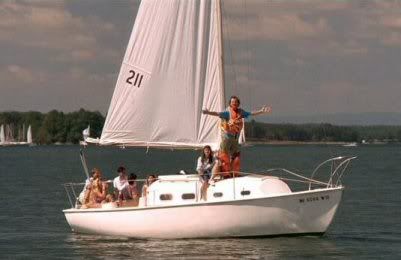
Lake Winnipesaukee booked for July

billandamy

New Member
Oct 22, 2007
3,043
Southwest CT
Boat Info
2008 205 sport. MonsterTower wakeboard tower.
Engines
5.0 mpi (260 hp) alpha one drive with 19p ss prop.
So we booked the house rental for Winni from July 18-25th

Anyone going to be up there at all during that time period? Or live near there and will be around? Been there and know of some good spots to dock up and eat or have some fun?

We are renting a really nice 4 br house in Alton Bay with dock. The kids especially are looking forward to it as they picked the house.
 
WhatAboutBob.jpg
 
I keep my boat there, take a look at www.winnipesaukee.com and consider a Bizer chart.

There are five towns with free public docking, each town has resturants and other attractions. A few resturants have docks but most rely on the town's. The hot spot to dock and drink is the Naswa in the Weirs channel.

There are a couple of hot sand bars, Braun Bay and West Alton seem the most popular. Consider trying them on weekdays. Weekends are too crowded. There are dozens of quiet places to anchor.

And make sure you have proof that you took a boating safety class acceptable to the NH Marine Patrol

And finally don't break the new speed limit 45 day 25 night
 
Last edited:
Wife and I were just talking about going there for a long weekend as it would be our first trip there with the boat.
Looking for suggestions as well.
 
I keep my boat there, take a look at www.winnipesaukee.com and consider a Bizer chart.

There are five towns with free public docking, each town has resturants and other attractions. A few resturants have docks but most rely on the town's. The hot spot to dock and drink is the Naswa in the Weirs channel.

There are a couple of hot sand bars, Braun Bay and West Alton seem the most popular. Consider trying them on weekdays. Weekends are too crowded. There are dozens of quiet places to anchor.

And make sure you have proof that you took a boating safety class acceptable to the NH Marine Patrol

And finally don't break the new speed limit 45 day 25 night
Great info, thank you!

I actually plan on getting a Garmin (from BOE of course, Jim) and buying that Bizer chart. I had that bookmarked last year. We bought the chamber of commerce dvd last year for info too, but nice to hear from a local what THEY feel rather than paid advertisements ;-)

We plan on doing most of the boating during the week so that we have more of a chance to dock and enjoy ourselves without major crowds.

CT boating license is supposedly one of the strictest and hardest to get in the US. Supposedly, ct doesnt accept other states' licenses according to my neighbor who moved here from NJ.

Thanks for the speed limit heads up too. I understand the patrol there is strict..as a matter of fact, right in the beginning of the dvd (which is geared toward boaters) it has a warning about the rules and laws!
 
Last edited:
If you only expect to spend a week there I would not invest in the electronic chart for your GPS. The Bizer paper chart is fine. Plus the paper chart has a bunch of extra info, like what resturants have docks and which one you can walk to from the town docks.

The other secret of the chart is "No Rafting Zones". In NH you cannot raft more than two boats together in a NRZ. So a NRZ on the chart really means that this is a good place to go and hang out. The NRZ are implemented in the good spots to keep the crowds under control. Once again on weekends these places are very crowded but on weekdays they are the best.

There are public docks in Alton Bay, they have a few places to eat and minigolf. Wolfeboro is a good place for you to visit from Alton Bay. It's not too far and it a much bigger town. There are many shops and restaurants.

For your safety, stay off the Broads area of the lake whenever there are north winds. Anything over 10 mph and there will be big waves on the south end of the Broads.

So on windy days, go up the west side of the lake behind the islands to Weirs Beach (arcades for the kids) or Meredith (nice restaurants)

One last thing, the speed limits are brand new so we all are waiting to see how they are enforced. The most common NH law infraction is the 150 foot rule. You must slow to no wake whenever you are 150 feet from another boat, shore, dock or swimmers.

Awesome info, thank you! I will be taking this thread and copying/pasting it into a word doc to bring along. I dont mind the $ of the bizer electronics. I believe we will be making this a yearly trip for a while, and speaking to bizer they will update at no charge year to year.

So at 150', no boats can go by each other while under power, or just past docked/moored boats? The latter I assume, but ya never know!
 
You must be 150' away from other moving boats or you both have to be at no wake speed. This means 6MPH. So you must give everyone a wide berth when passing or crossing. The 150' rule also applies to docks, the shoreline, islands, swimlines, anchored boats, diver's with flags. It doesn't apply to naviagation bouys or rocks (which are smaller than islands)

It's a broad rule which get broken almost constantly in the busy travel areas. The Marine Patrol usually doesn't ticket you unless the infraction is obviously unsafe, careless or intentional. But they will stop you and give you an earful.

Wow, that sounds dumb. I can maybe agree with anything "parked", but two moving boats passing or going in opposite directions? Seems more unsafe to make people circle around and take up a lot of room on the water forcing perhaps oncoming or passing traffic to then now go further out of the way onto oncoming or passing traffic and so on...


Seems like just another rule/law to collect revenue when it is needed for the tax base.
 
I lived in Moultonboro behind Trexlers Marina for 25 years and ran a 24' Sea Ray Sorrento until moving to the Chesapeake Bay for a longer boating season in 2000.

If nothing else, the lake level is critical, not bad during July as long as it was a decent winter. The rocks and markers are UNFORGIVING!!! The local Winnipesaukee map with markers is a must. A spare prop may help.

The longer season convinced me to sell the 24' Sorrento and buy a 35' Sea Ray Express Bridge......

Until of course we bougth a 50' slip in Chesapeake City and the 35' was too small for the slip.....

So we moved up to a 45' Sea Ray Express Bridge. I think it is a good thing we have maxed out our slip length!!

Enjoy Winnipesaukee, say hi for me and one day that my boating life is over, my ashes will be planted there in the "broads".
 
After reading some of the other replies, it looks like some things may have changed such as laws and available navigation equipment with good Winnipesaukee info since 2000.

One thing that I'm sure has not changed. Remember, it is easier and cheaper to churn mud than rocks! :smt001
 
I lived in Moultonboro behind Trexlers Marina for 25 years and ran a 24' Sea Ray Sorrento until moving to the Chesapeake Bay for a longer boating season in 2000.

If nothing else, the lake level is critical, not bad during July as long as it was a decent winter. The rocks and markers are UNFORGIVING!!! The local Winnipesaukee map with markers is a must. A spare prop may help.

The longer season convinced me to sell the 24' Sorrento and buy a 35' Sea Ray Express Bridge......

Until of course we bougth a 50' slip in Chesapeake City and the 35' was too small for the slip.....

So we moved up to a 45' Sea Ray Express Bridge. I think it is a good thing we have maxed out our slip length!!

Enjoy Winnipesaukee, say hi for me and one day that my boating life is over, my ashes will be planted there in the "broads".
Thus why I am buying the Bizer as well. Supposedly after speaking to a few people, that map has almost every rock and underwater blade breaker marked off on the GPS unit. Supposed to be very very accurate and get you anywhere pretty safely. I am definitely getting another prop anyway as you suggested!

Couldnt move more south. Boating is just another activity for us on top of the 100 we already have. We love winter :smt001
Leaving Thursday for a 4 day weekend, just the wife and I to our mount snow ski in/out condo with 2 snowmobiles for the four days. Cant do that from below CT.
 
You must be 150' away from other moving boats or you both have to be at no wake speed. This means 6MPH. So you must give everyone a wide berth when passing or crossing. The 150' rule also applies to docks, the shoreline, islands, swimlines, anchored boats, diver's with flags. It doesn't apply to naviagation bouys or rocks (which are smaller than islands)

It's a broad rule which get broken almost constantly in the busy travel areas. The Marine Patrol usually doesn't ticket you unless the infraction is obviously unsafe, careless or intentional. But they will stop you and give you an earful.

Wow, very strange requirements. Enforcement would indeed be difficult. I'm glad we don't have to worry about that on most lakes around here.
 
Just stay on the safe side of the markers and you will not hit rocks. It's a lot safer and easier than it sounds.

The Bizer chart or chip makes this worry-free.

I have the Bizer c-map chip in my Northstar GPS and it shows every hazard. They also will give you $100 if you find a hazard they don't have marked (it will help with the deductable) But remember they do not claim to mark all hazards within 150' of shore or where they already indicate the water is shallow.

Remember NH has a spar bouy system. Stay north or east of black & white spars and stay south or west of red & white spars. This can be damn confusing when you see a bunch of spars together, so just look at the chart. All the charts have a dotted line showing the prefered routes.

You usually cannot cheat the spars at all. I've seen big rocks within 2 feet of the bad side of a spar.

The 150 foot rule has some common sense applied. If you are doing a safe pass in the wide open and you're 100 feet from the other boat no one will care. But if you barrel into a crowded bay on plane, you will get noticed.

The rule of thumb is, if you can read their bow numbers you are too close.
Thank you for the spar information. I did not know this at all. Much appreciated!

I also understand the 150 rule now, basically use common sense. I guess it gives the patrol an easy "in" if they see someone driving wreckless. I just hope it isnt abused by patrol.
 

Forum statistics

Threads
113,229
Messages
1,428,965
Members
61,120
Latest member
jingenio
Back
Top