A trip to the water by car

Gofirstclass

Well-Known Member
Apr 20, 2010
11,690
Tri Cities, WA
Boat Info
Boatless in WA
Engines
No motor
I've lived in WA for over 40 years and have traveled over much of the state, but one area I haven't been to is the Olympic Peninsula. A couple of months ago my wife and I and her cousin and cousin's hubby were talking about a road trip and all agreed that would be a good destination.

My wife found a cabin in the woods about 5 miles south of Sequim on Airbnb so we booked it for four days/3 nights.

The trip over was beautiful and uneventful. We traveled to Seattle over Snoqualmie Pass then turned north to Edmonds to catch the ferry to Kitsap, a small town on the Olympic Peninsula. Here's our entry onto the ferry.
IMG-1290.jpg

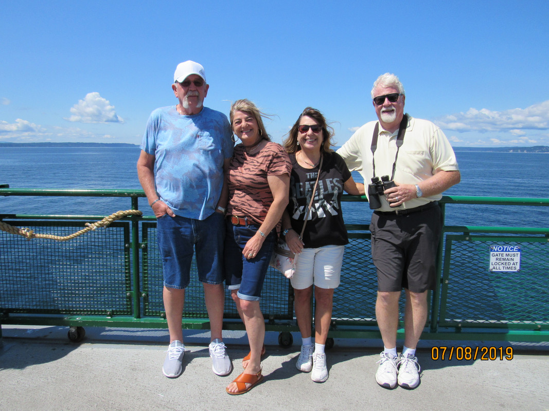
As you can see, the weather was perfect. Sunny skies, no winds, etc. Here's the four of us, Jim, Sandy, Tina and me.
IMG-1293.jpg


It's only a 35 minute trip on the ferry so we no sooner got up to the bow than it was time to return to our car.

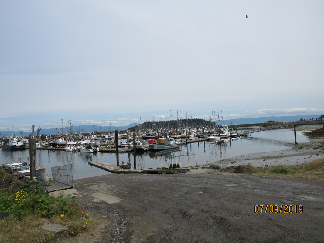
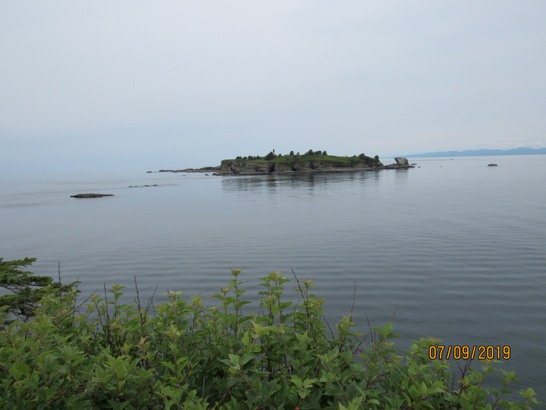
Here's a shot of the Strait of Juan de Fuca taken from a few miles east of Sequim. The mountains in the background are Canada.
IMG-1308.jpg


After a short tour of Sequim we drove out to the cabin and were a bit surprised to see deer along the roadway. All the deer we saw were Blacktail Deer and are quite small. We had a contest to see who could spot the most deer. Jim won with 12, his wife had 8, my wife had 11 and I had one. Not fair because I had to watch the road.
mad.gif

IMG-1303.jpg

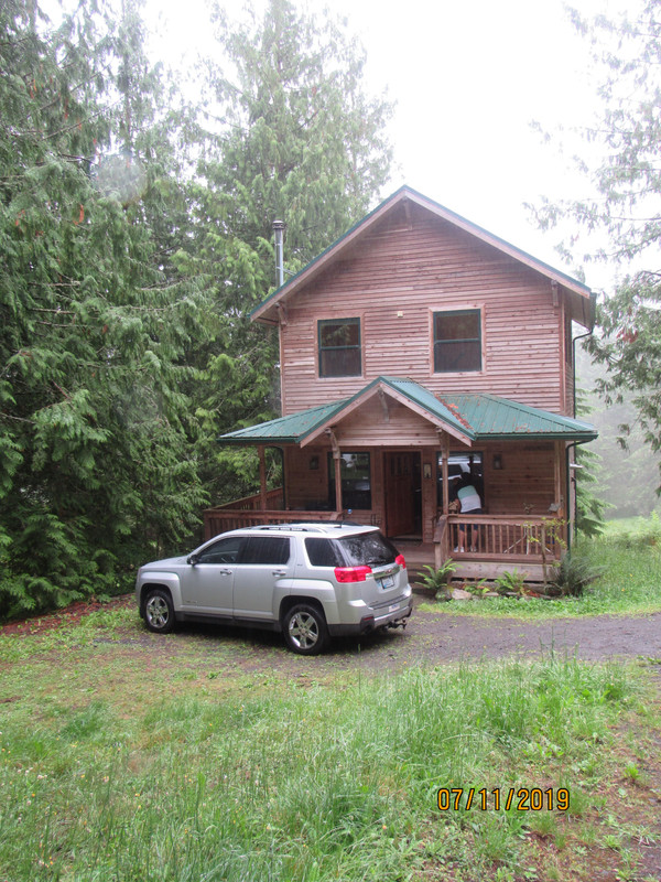
The cabin we rented was a 2-story with 2 bedrooms and 2 bathrooms, decks on three sides and was very comfortable.
IMG-1371.jpg

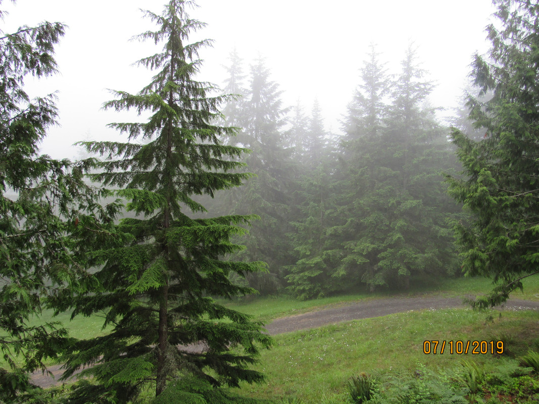
Here's the view from the front deck. Not a long distance, but pretty.
IMG-1345.jpg

(Continued)
 
We each had things that we wanted to do while we were there. Mine was to travel out to Neah Bay, a Makah Indian Village, and also to go out to Cape Flattery. Several years ago I helped a friend take a boat from Seattle to Stockton, CA and we had overnighted at the harbor at Neah Bay. It's a commercial fishing harbor and a nice marina.
IMG-1311.jpg

We took a quick tour of the town then had some great fish and chips then headed to Cape Flattery. The Cape is the furthest northwest that a person can to in the continental US. We had passed between it and Tatoosh Island when we rounded the point and it was nice to see it from land. Here's what the island looks like and the lighthouse on the island.
IMG-1328.jpg

See that rock between shore and the island, and the rocks just to the left and beyond the big rock, that's the path we took when we were taking that boat to CA.
IMG-1329.jpg

I found out from talking to a park ranger that the entire Cape Flattery sits above a labyrinth of tunnels that have formed over the years. She had kayaked back in there and she said those tunnels go for a mile or more. At some point (millions of years from now) they expect that the Cape will collapse. Here's what some of the tunnel openings look like.
IMG-1332.jpg


IMG-1333.jpg

The trail down to the Cape is about 1.3 miles long and we found out that what goes down must also come back up. Let me tell you that by the time we got back up we were all ready for a cool one. The trail starts out fairly steep and just a worn path several feet wide. Then it narrows down to a boardwalk and is still just about as steep.
IMG-1321.jpg

For the four of us who live in the desert of SE Washington it was especially nice to walk through the trees of the rain forest. Some of the trees are a bit spooky and have fairies of the forest among them.....
IMG-1324.jpg

The next day we drove up to Hurricane Ridge. It's aptly named because of the howling winds that whip through there. It was cloudy the day we drove up there and I didn't take any photos because we all know what clouds look like. Sorry.

That afternoon we drove out to Dungeness Spit, a five mile long finger that sticks out into the Strait. Again we got our exercise hiking out to the spit and walking along the spit.
IMG-1363.jpg

IMG-1369.jpg

IMG-1370.jpg

We spent a couple of hours just walking the beach (Now you know why my boat is named "Beachcomber"), picking up shells and stones. OOPS, no we didn't. I think that's some kind of national park or something so that would be illegal, so we really did not do any of that.


So that's about it. We had an uneventful ride back across on the ferry and an easy drive home. All told, we drove 994 miles in the 4 days, ate tons of fresh fish and had a great time. My wife had taken a couple of board games along but we were having so much fun just talking that we never even opened them.

Oh, one last pic that I thought was worth taking....
IMG-1334.jpg


I guess if she could put up with the yard full of old cars, trucks and boats it might not be bad.
 
I've been over there a couple of times, beautiful area.
Next time check out the Hoh Rain Forest.
Did you get with Doug and Lea while there?
You know that's real close to where they live.
 
I got in touch with Doug by phone but we didn't have time to connect with them. That's the problem when you only have 4 days to see a whole bunch of forest and other scenery.
 
Great pics! Two years we visited some old friends in Seattle who took us out on their boat around the bay. Beautiful! A few years prior to that, we hiked Banff in Canada which was spectacular ! If I could afford it, Id have a boat there too.
 
Great pics! Two years we visited some old friends in Seattle who took us out on their boat around the bay. Beautiful! A few years prior to that, we hiked Banff in Canada which was spectacular ! If I could afford it, Id have a boat there too.
We have done a couple of bare boat charters up there. Where else can you be on the boat and see snow covered mountains...
 
We each had things that we wanted to do while we were there. Mine was to travel out to Neah Bay, a Makah Indian Village, and also to go out to Cape Flattery. Several years ago I helped a friend take a boat from Seattle to Stockton, CA and we had overnighted at the harbor at Neah Bay. It's a commercial fishing harbor and a nice marina.
IMG-1311.jpg

We took a quick tour of the town then had some great fish and chips then headed to Cape Flattery. The Cape is the furthest northwest that a person can to in the continental US. We had passed between it and Tatoosh Island when we rounded the point and it was nice to see it from land. Here's what the island looks like and the lighthouse on the island.
IMG-1328.jpg

See that rock between shore and the island, and the rocks just to the left and beyond the big rock, that's the path we took when we were taking that boat to CA.
IMG-1329.jpg

I found out from talking to a park ranger that the entire Cape Flattery sits above a labyrinth of tunnels that have formed over the years. She had kayaked back in there and she said those tunnels go for a mile or more. At some point (millions of years from now) they expect that the Cape will collapse. Here's what some of the tunnel openings look like.
IMG-1332.jpg


IMG-1333.jpg

The trail down to the Cape is about 1.3 miles long and we found out that what goes down must also come back up. Let me tell you that by the time we got back up we were all ready for a cool one. The trail starts out fairly steep and just a worn path several feet wide. Then it narrows down to a boardwalk and is still just about as steep.
IMG-1321.jpg

For the four of us who live in the desert of SE Washington it was especially nice to walk through the trees of the rain forest. Some of the trees are a bit spooky and have fairies of the forest among them.....
IMG-1324.jpg

The next day we drove up to Hurricane Ridge. It's aptly named because of the howling winds that whip through there. It was cloudy the day we drove up there and I didn't take any photos because we all know what clouds look like. Sorry.

That afternoon we drove out to Dungeness Spit, a five mile long finger that sticks out into the Strait. Again we got our exercise hiking out to the spit and walking along the spit.
IMG-1363.jpg

IMG-1369.jpg

IMG-1370.jpg

We spent a couple of hours just walking the beach (Now you know why my boat is named "Beachcomber"), picking up shells and stones. OOPS, no we didn't. I think that's some kind of national park or something so that would be illegal, so we really did not do any of that.


So that's about it. We had an uneventful ride back across on the ferry and an easy drive home. All told, we drove 994 miles in the 4 days, ate tons of fresh fish and had a great time. My wife had taken a couple of board games along but we were having so much fun just talking that we never even opened them.

Oh, one last pic that I thought was worth taking....
IMG-1334.jpg


I guess if she could put up with the yard full of old cars, trucks and boats it might not be bad.
Looks like a great trip sure makes me miss the west coast.
 
Great pictures. We decided to break up the long plane ride on an upcoming trip to Hawaii this winter and spend 2 nights checking out Seattle. It will be our first time there. Just going to take in a few sights and have a couple of good meals. Hopefully, if we like it we can make more time for a longer trip to that area in the future.
 
We transited that area last year on a cruise ship on the way to Alaska. I was amazed at the beauty of the area from a distance - even more so from your close-up photos.
 

Forum statistics

Threads
113,118
Messages
1,426,555
Members
61,035
Latest member
Lukerney
Back
Top